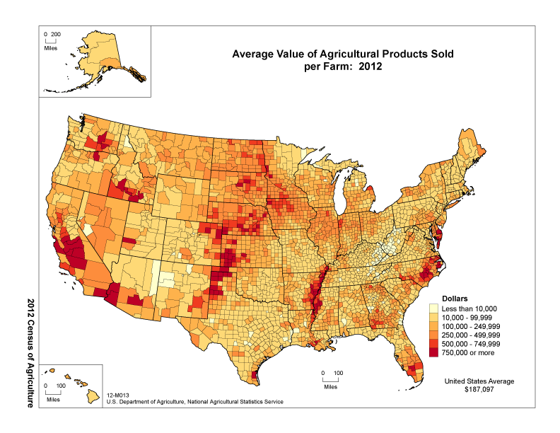
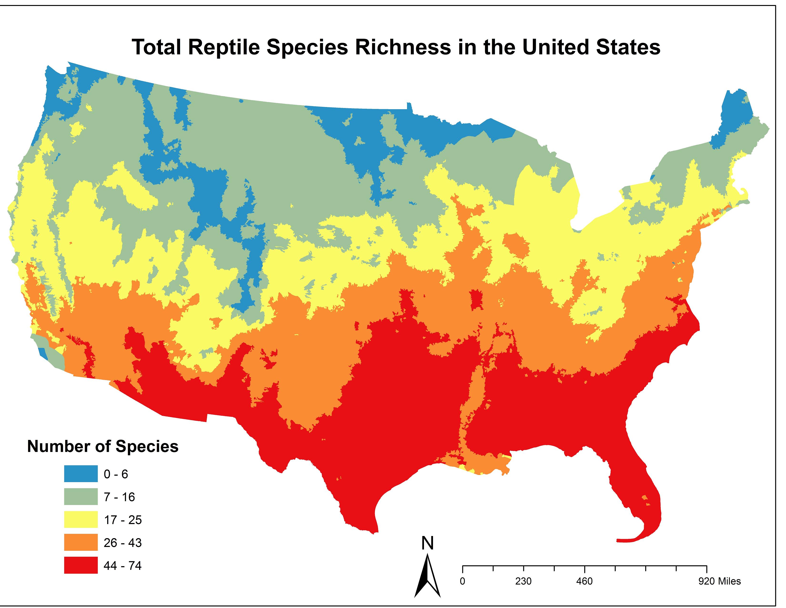
The reptiles mostly were ploughed away and replaced with soy beans.

The low reptile diversity zone matches the Mississippi Alluvial Plain which includes the Mississippi Floodplain. The Mississipi drains nearly half of the USA's geographic area, so the flood plain is massive.
The Silt Plain is very flat, mostly has hills left by oxbow lakes and river meanders. If you put your hand in the ground, it consists of organic matter/silt/clay/mud/fine sand, and it is very fertile until it is depleted by modern agricultural practices.
It's one of the more productive agricultural regions in the USA, and it's mostly giant square fields and mono cultures.
zoom in: http://gokml.net/maps#ll=32.163208,-91.720681&z=11&t=h&q=winnsboro
Here is a quote from the Discussion at the end of this review:
traditional agricultural landscapes, typically characterized by
mosaic–like structures, intermediate levels of disturbance, and able
to host great biodiversity levels (Bignal & McCracken, 1996), have
undergone profound transformations in last decades. The rapid
extension of intensively cultivated fields and the reduction and
fragmentation of the original habitats have led to the creation of
more uniform and depleted landscapes, with significant loss of
biodiversity (Whittaker, 1975; Bull & Skovlin, 1982; Burel et al.,
1998; Zechmeister & Moser, 2001; Moser et al., 2002; Pfiffner & Luka,
2003). In accordance with these changes, our analysis of reptile
assemblages in an agricultural area mainly devoted to the intensive
cultivation of arable lands found the landscape to be relatively poor
in biodiversity. Four out of five agricultural land uses hosted only
one species, while most of the recorded reptiles occurred inside a few
patches of semi–natural habitats and, above all, in the grid of
vegetated buffer strips interspersed among the cultivated lands. In
addition, during field activity, we observed only seven of the
eighteen species of terrestrial reptiles reported for the province
where the sites are located, and most records were ascribable to a
single species.
Reptiles and Amphibians are at the top of the insect food chain, and studies have shown that they are sensitive to pesticides, especially when their numbers are low:
By using three evaluation factors - (i) pesticide exposure, (ii)
physiology and (iii) life history - a taxon-specific pesticide
exposure risk factor (ERF) was created. The results suggest that about
half of all evaluated species, and thus at least 1/3 of all European
species exhibited a high exposure risk. Previously the region would
have been host to a very tall high growth forests, because of the high
temperatures, available water table of the area and fertility.
you can check pics 6 and 8 from this page to see the productivity of the region. It suggests that the reptile biomass was replaced with obese humans.
That forest has been reduced to the swamp forests where the roots are covered in stagnant water for most of the year, where some large aquatic reptiles take refuge, and which is completely different than the lost forests of the Mississippi plains.
The old forests would have perhaps been similar to florida's inland forest, and perhaps very different, because of the available water table, and much more productive silt, than florida's ground allows for. I didn't manage to find photos of the lost forests of Mississippi plain regions, they would have been dense, producing 3-7 times more biomass than normal forests.


