6
$\begingroup$

I often use BONAP's North American Plant Atlas, for researching plant taxa ranges.

BONAP maintains relatively complete phytogeographic and related botanical databases for all free-living vascular plants found in North America (north of Mexico). For over four decades, we have worked collaboratively with many federal and state government agencies, private groups and individuals across the continent to produce and edit our databases

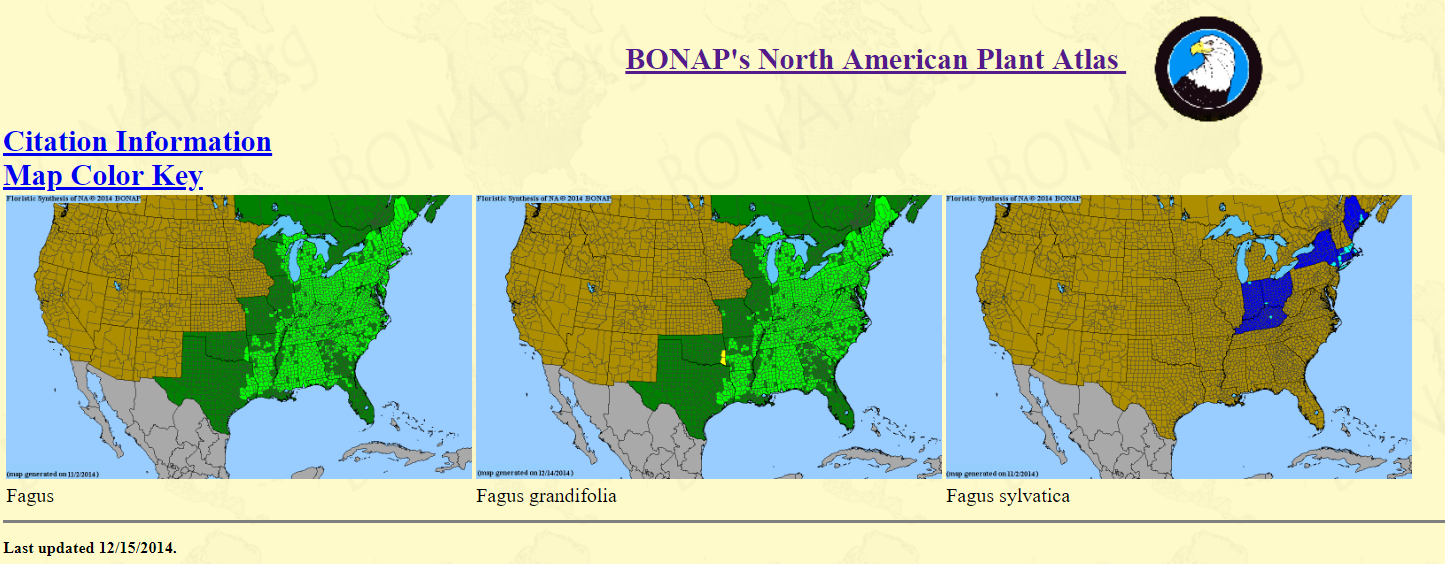
It generates incredibly useful range maps, and I can search by higher taxa (i.e., genus) to investigate many species based on their ranges at once. For example, Fagus:

enter image description here

However, I have so far been unable to find a similar online atlas (or any range-map query tool) for insects.

Does anyone know of any similar range-map resources for insects?

  • I'm most interested in maps for the US, but global maps would be incredibly awesome :)
$\endgroup$
2

4 Answers 4

4
$\begingroup$

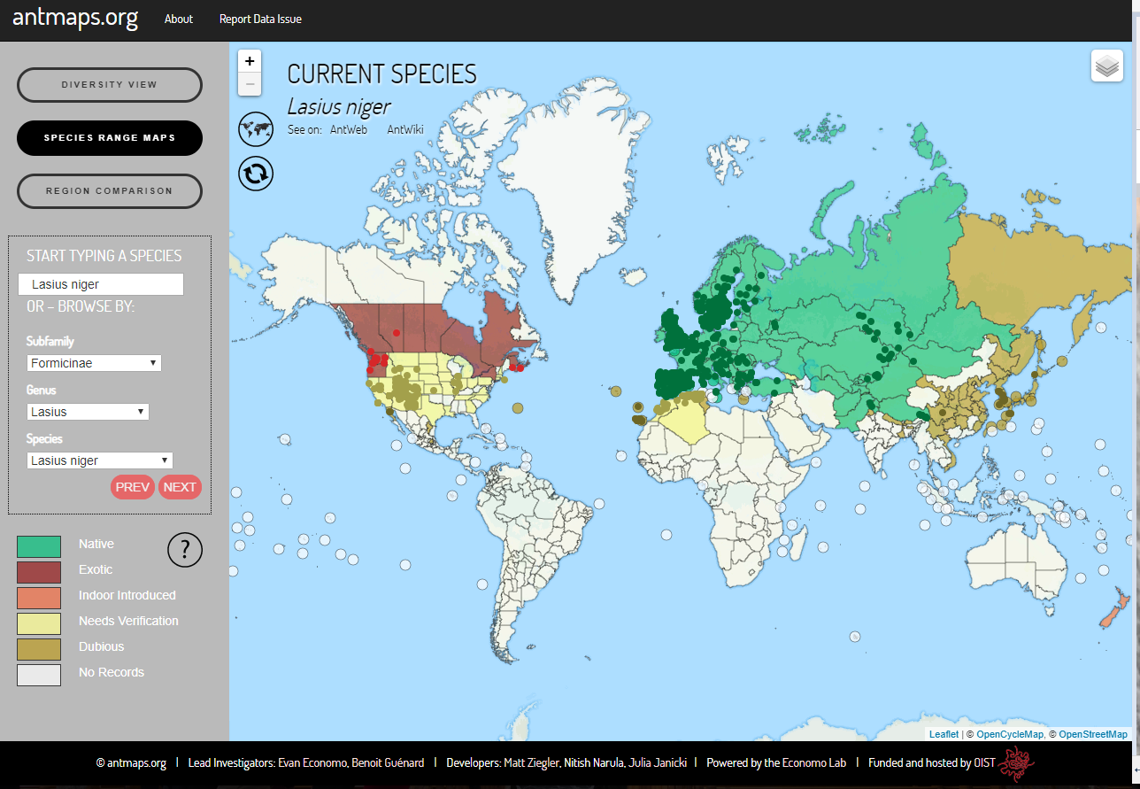
I've just recently discovered a range map site for ants: antmaps.org.

enter image description here

Image: Interactive range map for L. niger from antmaps.org

From the site's about section:

antmaps.org is not a database per se, but rather a client-end tool for visualizing and interacting with the GABI database. The Global Ant Biodiversity Informatics (GABI) project (Guénard et al. 2017 Myrmecological News) is an attempt to consolidate and curate a comprehensive global database of ant species distributional records, including literature records, museum databases, and online specimen databases.

As of July 2018, the database includes records from over 9300 publications, most major digitized museum collections, and specimen databases such as AntWeb. In total, the database now has over 1.9 million records including around 15000 described ant species and subspecies. The GABI data are currently housed in a PostgreSQL database that synchronizes once per week with antmaps.org.

The site also suggests other useful ant websites:

Antmaps.org is intended to complement other invaluable web tools for myrmecology such as AntWeb and AntWiki.


Citations:

Guénard, B., Weiser, M., Gomez, K., Narula, N., Economo, E.P. (2017) The Global Ant Biodiversity Informatics (GABI) database: a synthesis of ant species geographic distributions. Myrmecological News 24: 83-89.

antmaps.org paper to cite if you view data using this tool: Janicki, J., Narula, N., Ziegler, M., Guénard, B. Economo, E.P. (2016) Visualizing and interacting with large-volume biodiversity data using client-server web-mapping applications: The design and implementation of antmaps.org. Ecological Informatics 32: 185-193

$\endgroup$
4
$\begingroup$

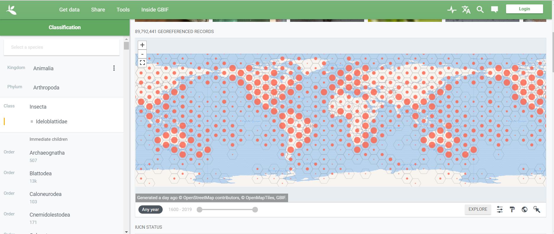
I think the Global Biodiversity Information Facility (GBIF) may be what you are looking for https://www.gbif.org. It is not limited to plants and insects.

enter image description here

$\endgroup$
1
  • $\begingroup$ GBIF seems to be very good given it's amazing breadth of taxa. Thanks! $\endgroup$ Commented Dec 13, 2019 at 4:19
3
$\begingroup$

Now I've found a range map site for lepidopterans of North America:

https://www.butterfliesandmoths.org/taxonomy

The Butterflies and Moths of North America (BAMONA) project is indebted to thousands of individual citizen scientists who participate in data collection and review. Nearly all of the sighting data and photographs available on the BAMONA website are submitted by volunteers who take the time to share and document their sightings. Volunteer regional coordinators are responsible for data quality control and general scientific oversight, and many coordinators put in hundreds of hours of volunteer time each year.


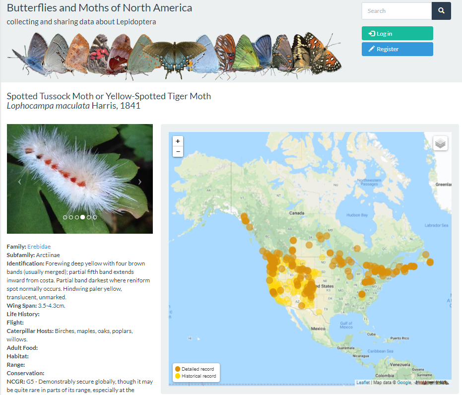
Once you select a given species, the site generates a range map of known and historical records.

For example, for Lophocampa maculata:

enter image description here

$\endgroup$
2
$\begingroup$

A comment on another SE post has made me aware of yet another source for arthropod maps:

European Centre for Disease Prevention and Control's Tick Maps:

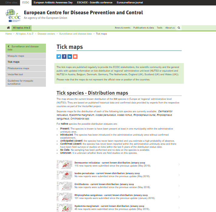
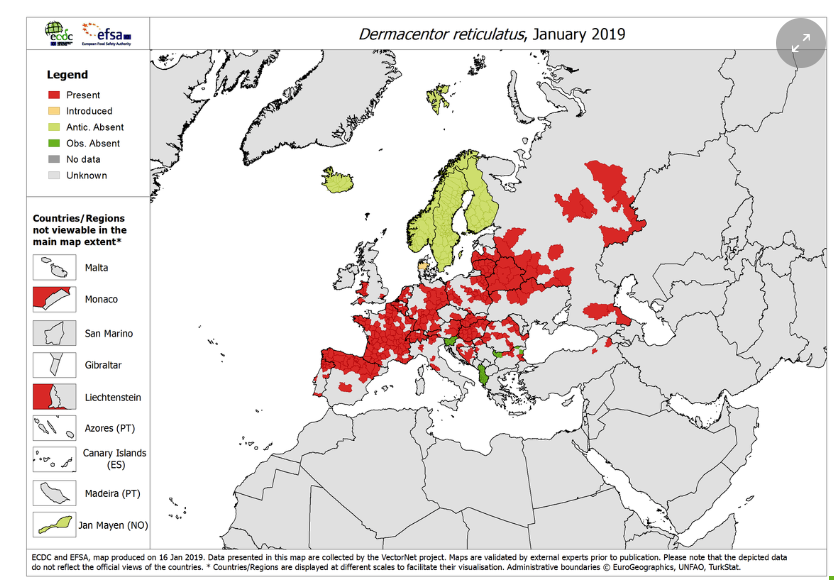
The tick maps are published regularly to provide the ECDC stakeholders, the scientific community and the general public with updated information on tick distribution at ‘regional’ administrative unit level (NUTS3 or equivalent and NUTS2 in Austria, Belgium, Denmark, Germany, The Netherlands, England (UK), Scotland (UK) and Wales (UK)).

Screenshots of the main page and an example map can be seen below:

enter image description here

enter image description here


The ECDPC site also provides maps for mosquitoes and sandflies in the included European countries.

$\endgroup$
1
  • $\begingroup$ Nice! Maybe we should start a Wiki for this kind of info. $\endgroup$
    – RHA
    Commented Dec 21, 2019 at 10:29

You must log in to answer this question.

Not the answer you're looking for? Browse other questions tagged .